Tuesday, October 18, 2011
More stuff about the pictures
I just found out that by clicking on any of the pictures and then rolling the "mouse" thing, you can see all of the shots a little bigger. Just click off the picture and it returns to the "dribble", I mean blog. Whatever.

Fall Trip North -2011
I started this trip on Monday 10/11 at about noon and made it to Lone Pine, Ca. I found a great Forest Service camp up the hill to the west. For those of my Sierra hiking group. it is off the road to Horseshoe Meadow - Tuttle Creek - on the level part before it starts to climb. A great campground and with my "senior pass" it was only $2.50 a night. No hookups but a wonderful view of the road to Onion Valley (the road leading to the trail head for Kearsarge Pass hike. That night I did get the sensation that my camper was not as level as I had set it up to be. In the morning I found out why - a flat tire on the (down hill side) left rear (of course the most difficult to change). So after breakfast I got my morning exercise. I headed to the tire shop, here in town, and found out that the tires I had on my truck were designed of a passenger car / light truck. The road up to the campground was a dirt road but seemed OK - I guess having all of this weight and any sharp rock are not a good match.
So I decided to bit-the-bullet and get 4 new, heavy duty tires - not that I haven`t gotten really good at changing tires but............ I also found out that my old tires were at best nylon 3 ply and the new ones are steel 10 ply - take that you ROCKS. I will now have more confidence if I need to drive on dirt roads in the future.
Being as how it was now about 10:30 and the shop would need my truck until sometime after lunch, I thought a bicycle ride was in order. I have had on my "bucket list" for several years a ride from HWY. 395 up to Horseshoe Meadows (a roughly 6,000` climb). It is a long switchbacking road up the side of the mountains just south of Mt. Whitney in the Sierra Nevada range. We have started our hikes at the trail head and I have wanted to give it a try.
Being that I had to be back to pick up my truck by 5:00 and starting rather late, I made it about 2/3 of the way up in about 2 hours. At that point needing more water and the effort needed to get the rest of the way up, caused my to head back down. I got 15.1 miles/ 30.2 round trip and the trip back only took about 1 hour (going up - 5 mph & going down 25/30 mph).
I opted for a full hookup RV park tonight so I could get cleaned up and BLOG.
Headed for a place just north of Bishop, Ca. - hiking at a trail head up Rock Creek Rd. tomorrow.
I know "how about some pictures" well check them out.

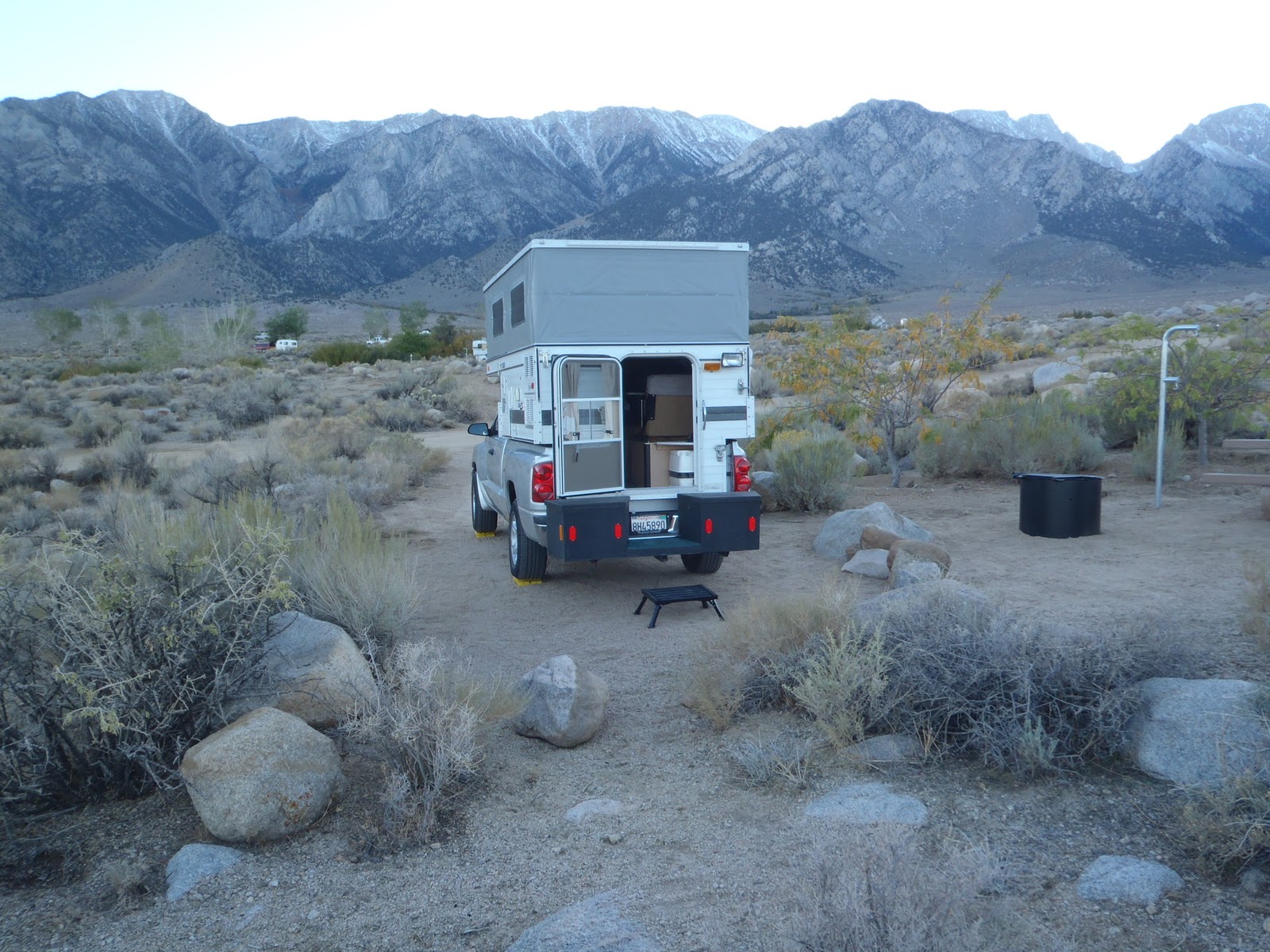
 Not a bad back yard and it looks like a recent light dusting of snow on the tops of the mountains
 I found out about a different way to get to the Horseshoe Meadow road. Since I was south of Lone Pine, I headed further south (3 miles) to a road up that connected a the base of the climb. It saved me about 12 miles from having to go back to Lone Pine and then up to the turn off to the left from the Onion Valley road.
 This one is for you Mary, I found it in the middle of the climb to Horseshoe Meadow - notice the yellow line which is the center marking for the road. I did not have to worry about traffic since only two cars passed me the entire way up. There is one at each of the switchbacks on the road - this was the best - I guess there is something under this cap but I could not budge it.......
 This is a view of Lone Pine (the green patch in the distance) from part way up the mountain (looking northeast up the Hwy. 395 valley) & you can make out the road I took up at the left, beyond the trees.
 Part of the road up & going back down was fun but tiring on the hands - braking all the way.
 A look up to where the road goes from the point where I turned around. It was still a ways and (for an old guy) not a bad ride. I figure about 4,200` climb ending at about 8,000` elevation. That is off the list even though I did not make it to the top - close enough!
 Back down and I thought a look at the climb might help (it is a little hard to see). You can make out the switchbacks and the reflection from a car on the climb. I think if you click or double click the picture, it makes it bigger.
That is all for now, Cheers.
So I decided to bit-the-bullet and get 4 new, heavy duty tires - not that I haven`t gotten really good at changing tires but............ I also found out that my old tires were at best nylon 3 ply and the new ones are steel 10 ply - take that you ROCKS. I will now have more confidence if I need to drive on dirt roads in the future.
Being as how it was now about 10:30 and the shop would need my truck until sometime after lunch, I thought a bicycle ride was in order. I have had on my "bucket list" for several years a ride from HWY. 395 up to Horseshoe Meadows (a roughly 6,000` climb). It is a long switchbacking road up the side of the mountains just south of Mt. Whitney in the Sierra Nevada range. We have started our hikes at the trail head and I have wanted to give it a try.
Being that I had to be back to pick up my truck by 5:00 and starting rather late, I made it about 2/3 of the way up in about 2 hours. At that point needing more water and the effort needed to get the rest of the way up, caused my to head back down. I got 15.1 miles/ 30.2 round trip and the trip back only took about 1 hour (going up - 5 mph & going down 25/30 mph).
I opted for a full hookup RV park tonight so I could get cleaned up and BLOG.
Headed for a place just north of Bishop, Ca. - hiking at a trail head up Rock Creek Rd. tomorrow.
I know "how about some pictures" well check them out.


That is all for now, Cheers.
Friday, August 26, 2011
Sierra Hking trip continued


Here we are coming back down the ridge and you can see a long way (looking north) over some of the country we had hiked. Very inspiring.

Down at the bottom and happy to have made the hike (about 12 miles round trip from our camp at Sunrise Lake).

Back at camp and evening shadows signal dinner time. A chance for all to relax and reflect on the day. Having chairs and a great cook really made the trip enjoyable.

I know, another reflection picture but I like rocks & water. This one is at Cathedral Lake which we camped at twice and hiked all the way around.

Our hard working cook Renee and here "kitchen" . It was after breakfast on our last morning and cold. But she managed a smile for the camera while doing the dishes. Just the night before we had been treated to a Thanksgiving style dinner -a whole baked turkey with: stuffing; cranberry & yams. It was excellent and served at 9,427` elevation, it was amazing.

One last reflection shot - this one at lower Cathedral Lake (elev. 9,288`) and our shadows are in the foreground. This lake is like an infinity pool, the way it drops off at the far end on it`s way down to Tenaya Lake (not visible in the distance).

At the end of our trip we talked with the owner of Rock Creek Pack Station, Craig London. We have now, over the course of several years, completed the entire John Muir Trail (212 miles total). Already the planning has begun for next years hike and that is half the fun. It is also what gets us through the winter - I know, Santa Barbara`s winter are not the same as other places but it does rain and get colder!
I hope you enjoy traveling with me.
Cheers
Tuesday, August 23, 2011
Another trip with pictures
I know it has been a while since I posted to this blog but nothing significant was happening. I ended my travels in my camper and have been home just catching up on things.
I just got back from a hiking trip on the John Muir Trail (August 12 - 22) and now have some great pictures to share.
Our trip started in Reds Meadow which is near Devils Postpile National Monument just west of Mammoth, Ca. This right on the John Muir Trail and we ended up at Tuolume Meadow in the high country of Yosemite National park. We covered about 90 miles in nine days of hiking and crossed three passes (Island Pass - elevation 10,206` / Donohue Pass - elevation 11,056` / Cathedral Pass - 9,700`) .
I know, show me the pictures.......


 Above are three pictures of Rosalie Lake on our second day as we headed towards Garnet Lake .
 Garnet Lake (elevation 9,678`) with Banner Peak (elev. 12,936 at right) and Mt. Ritter (elev. 13,143` on the left) at the west end of the lake. Yes, that is snow and a lot of it at the base of the mountains.


 Here we stopped for lunch at the top of Donohue Pass (elev. 11,056`) and to enjoy the view. We tucked in behind the granite boulders to avoid the cold wind. Note the large patch of snow in the background.
I just got back from a hiking trip on the John Muir Trail (August 12 - 22) and now have some great pictures to share.
Our trip started in Reds Meadow which is near Devils Postpile National Monument just west of Mammoth, Ca. This right on the John Muir Trail and we ended up at Tuolume Meadow in the high country of Yosemite National park. We covered about 90 miles in nine days of hiking and crossed three passes (Island Pass - elevation 10,206` / Donohue Pass - elevation 11,056` / Cathedral Pass - 9,700`) .
I know, show me the pictures.......


This is Ruby Lake (elev. 9,980`) that we passed while still on day two.

Renee, our cook, hard at work in her "kitchen" that had to be disasembled / transported and reassembled every day we moved to a new camp. She was amazing at preparing us breakfast and dinner every day.

I had to get into the picture - here at Thousand Island Lake (elev. 9,833`). This is just below our camp for the second and third nights. We had a layover day on which we hiked over to an overlook of Gem Lake -just for something to do.


Due to the abundance of water and the fact that our trip this year was earlier, there were a lot of wild flowers. Above are just a few.

An early morning look at the outflow area of Thousand Island Lake before the wind came up. Below is Banner Peak dominating the skyline as reflected in a small unnamed pond on our hike over Island Pass. This is on day four of our hiked north on the way to Lyell Canyon.


A view from near the top of Donohue Pass looking back to the valley we had crossed. There is a body of water in the middle of this picture that is easily 200` long. It is hard to imagine how big this valley is but something the size of a large school buss would barely be visible by the water (center of shot).

I will continue with more tommorow!
Monday, July 11, 2011
Day 34 - Glenwood Springs, Co. - Arches National Park, Utah
I drove into Utah on the same day that I rode to the top of the mesa in Colorado National Monument. I then headed for Arches National Park (just west of the border with Colorado on Hwy. 70).
![]() It was great scenery along the way after crossing the border into Utah.
It was great scenery along the way after crossing the border into Utah.
![]() There I go driving and taking pictures again, but I did not have a good place to stop, so that makes it legal ?
There I go driving and taking pictures again, but I did not have a good place to stop, so that makes it legal ?
![]() Definitely storm clouds brewing in the distance (this is looking east).
Definitely storm clouds brewing in the distance (this is looking east).
![]() Lots of large formations all around.
Lots of large formations all around.
![]()
![]() Great clouds help to make better pictures. This is called 'Courthouse Tower" and stands apart from other formations.
Great clouds help to make better pictures. This is called 'Courthouse Tower" and stands apart from other formations.
![]() A look at "Balance Rock" with a cloud that appears to be smoke comming out of the top. Well I thought it could look like smoke, whatever.
A look at "Balance Rock" with a cloud that appears to be smoke comming out of the top. Well I thought it could look like smoke, whatever.
Next are several pictures of what the park is named for - arches.
![]() Notice the cars at the right of this shot. Then the same formation but closer and with people in the opening for prespective.
Notice the cars at the right of this shot. Then the same formation but closer and with people in the opening for prespective.
![]() And closer yet.
And closer yet.
![]() There are actually two 'arches" right together and looking at both it almost apperas to be a mask of a sort.
There are actually two 'arches" right together and looking at both it almost apperas to be a mask of a sort.
![]() I got halfway through the park and decided that I was not enjoying everything. The heat / crowds / rains & missing the Tour de France coverage on TV were just dragging me down. I had a lot of fun but I felt that it was time to go home, so I did.
I got halfway through the park and decided that I was not enjoying everything. The heat / crowds / rains & missing the Tour de France coverage on TV were just dragging me down. I had a lot of fun but I felt that it was time to go home, so I did.
Many great memories so no sence in pushing it. I will finish up with the parks in Utah in October or next spring.
That is all for now. I hope you enjoyed following my travels as much as I had doing them.
Bob


Next are several pictures of what the park is named for - arches.


Many great memories so no sence in pushing it. I will finish up with the parks in Utah in October or next spring.
That is all for now. I hope you enjoyed following my travels as much as I had doing them.
Bob
Day 33 - Glenwood Springs, Co. - Colorado National Monument
I had been in Glenwood Springs years ago on a bicycle tour so I had several rides planned but..... The rain had washed rocks down from the surrounding hills and the roads were a mess. Also a bicycle path that parallels Hwy 70 through a beautiful canyon was flooded the Colorado River. So I found a great RV park and did a little driving around.
![]() They have a lot of "rocks" around here so everyone uses it for their town signs - no maintenance!
They have a lot of "rocks" around here so everyone uses it for their town signs - no maintenance!
![]() The town is situated in a valley with red sandstone hills all around. It is a big ski town in the winter.
The town is situated in a valley with red sandstone hills all around. It is a big ski town in the winter.
![]()
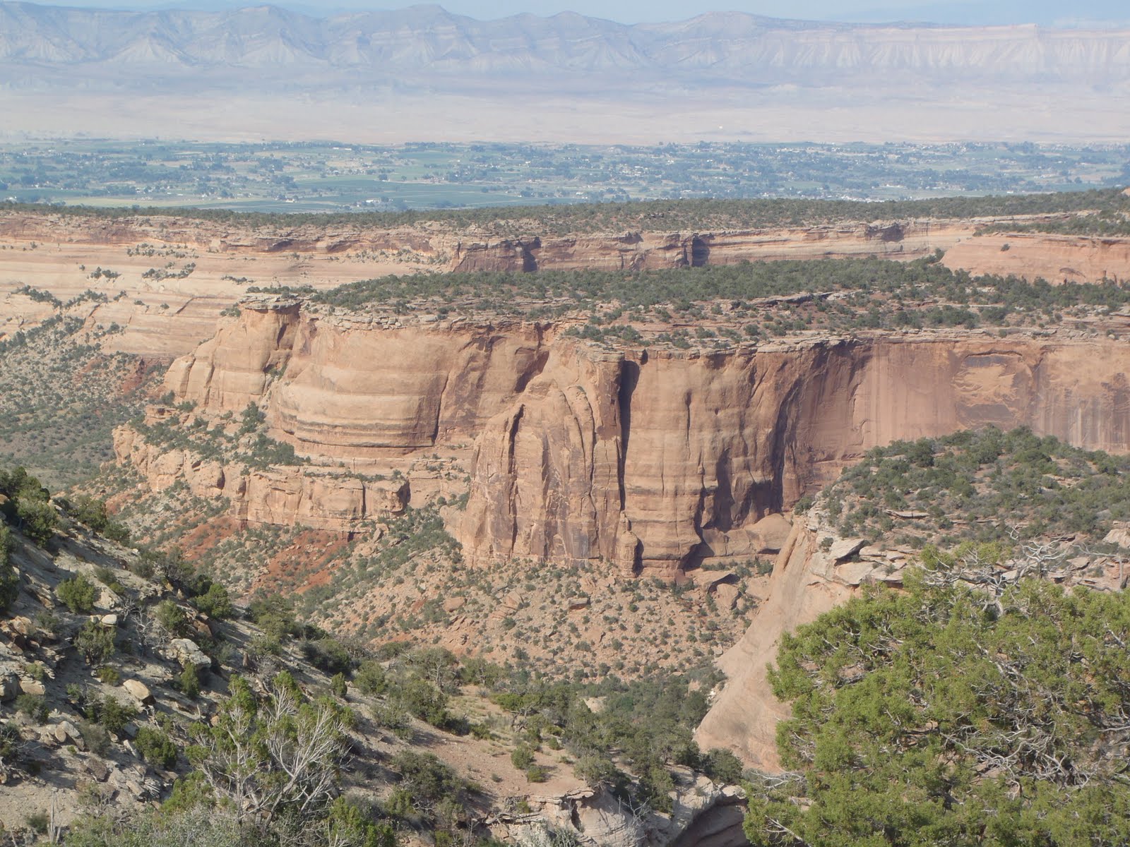
On to Colorado National Monument (located just west of Grand Junction, Co, - almost to the border with Utah). As you can see from this picture, the park is on top of a large "mesa" and is surrounded by deep canyons.
It is a 2,000` climb to get up into the park and is a very twisty road but great views from on top.
![]()
![]()
![]() This formation is called "Independence Monument" and you can see the town in the background.
This formation is called "Independence Monument" and you can see the town in the background.
![]() There are some interesting formations.
There are some interesting formations.
![]() And great views.
And great views.
![]() The roads are in beautiful shape and I got to ride this one the next morning when there was no traffic. The clouds were nice also.
The roads are in beautiful shape and I got to ride this one the next morning when there was no traffic. The clouds were nice also.
![]() Some big canyons that you could get lost in.......
Some big canyons that you could get lost in.......
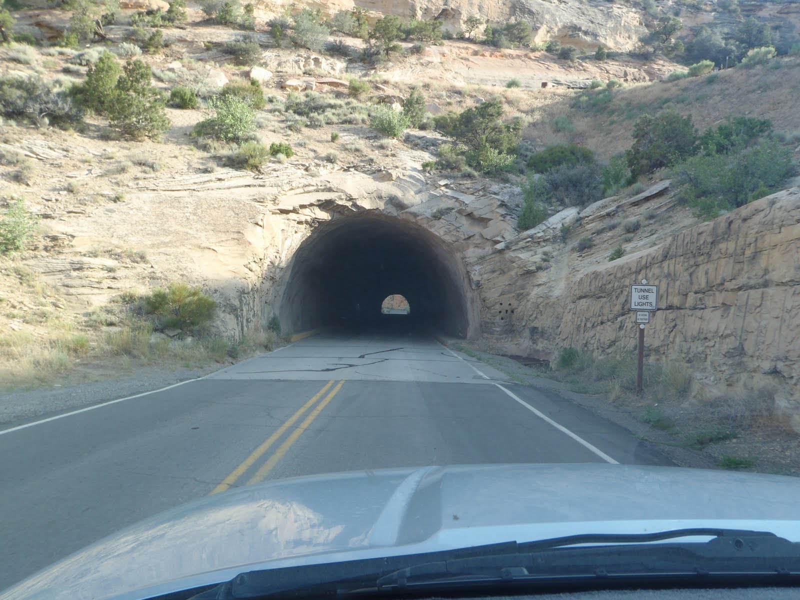
![]() The next morning when I rode my bicycle up to the top of the mesa and had to go through several tunnels. This one was straight but another was curved and fairly long. It was dark in there and a little scary if a car came while I was inside the tunnel. The ride was 2,000` of elevation change but the road on top was great (see other picture). Beautiful location and not to many people.
The next morning when I rode my bicycle up to the top of the mesa and had to go through several tunnels. This one was straight but another was curved and fairly long. It was dark in there and a little scary if a car came while I was inside the tunnel. The ride was 2,000` of elevation change but the road on top was great (see other picture). Beautiful location and not to many people.
The end for today.


It is a 2,000` climb to get up into the park and is a very twisty road but great views from on top.




The end for today.
Subscribe to:
Posts (Atom)