For those of you who are following this disjointed travel log, all I can say is thanks for waiting. I have been a little distracted and as you noticed, have not been keeping up with my blog.
I will add a few more pictures from my fall drive which went up through the eastern Sierras / into Nevada (to visit my brother) / over to Great Basin N. P (still in Nevada on the east side) and then down to Zion N. P. for some hiking.
This is Saddleback Lake (elevation 10,066`) which is just off the east road into Yosemite N. P. I decided to camp here one night and hike around the lake (the big one) - this is taken from the far end of the lake. The smaller lake at the left is Hummingbird Lake.
Above is a wierd shot I noticed while standing on a sloping granite rock which is why it is so distored. Whatever!
The next day I took a hike (in Yosemite) starting at Tenaya Lake ( elev. 8,150`) up to Sunrise Lakes (elev. 9,427` pictured here). It was about a 10 mile round trip and the day was perfect.
This hike started at Virginia Lake (just north of Mono Lake and yes we are still in California). My starting point is below just out of sight and I am looking east and my trail (seen on the left) leading up to this overlook.
This is Blue Lake which is the last lake I passed on my way back down.
I could not resist this shot of a large rock that someone had painted up Lundy Canyon- it is about 7` tall.
This is a shed in the RV park in Lee Vining where I stayed before heading into Nevada. I took this one is for Mary to give her ideas for "yard art".
That enough for now.......
Friday, December 28, 2012
Tuesday, November 13, 2012
Fall Drive 2012 - 4
I bought a new internal frame backpack last December and have been wanting to try it out. This means a self supported hike carrying all my gear, something I have not done for many years. As you may know all of our hiking trips along the John Muir Trail and others have been with packers toting everything but a small day pack. So I needed to see if I could still "do it alone" and carry a 25-30 lb. pack.
This hike was from the end of Rock Creek Canyon at the trail head called Mosquito Flat Trail Camp. My destination was Morgan Lakes which are over Morgan Pass (elev. 11,155`).
The trail at this point is good and follows around Long Lake.
I found a great camp spot which was off the main trail and sheltered from the wind by these trees. The day was overcast and cool but nice hiking weather.
This is the view from camp of a small (unnamed) lake.
Panning to the right this lake offered a perfect reflection of the surrounding hills.
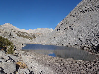
The next morning the sun was out and the wind was gone - perfect day. This is one of the Morgan Lakes which are quite barren,
One last lake with Morgan Pass in the background. Great hike and I made it ok.
Fall Drive 2012 - 3
Today I hiked up the trail toward Bishop Pass (which is west of the town of Bishop, Ca) but this was only a day hike. The aspen trees and fall colors are just at their peak and the weather is cool in the morning and pleasant during the day.
These are a few of the beautiful lakes I passed. You can make out the trail along the right side of these lakes, partway up the hill. I truned around about 2:00 PM and covered about 5-6 miles (round trip).
Thats all for now
These are a few of the beautiful lakes I passed. You can make out the trail along the right side of these lakes, partway up the hill. I truned around about 2:00 PM and covered about 5-6 miles (round trip).
Thats all for now
Tuesday, October 9, 2012
Fall Drive 2012 - 1
I headed north to do a little hiking in the Sierras. The plan is to hit several trail heads and see some new country.
I started with a drive up the road west out of Bishop, Ca. up towards South Lake. The aspen trees are changing colors and I could have spent the whole day taking pictures. So here are a few.
With a waterfall / rocks & fall colors, how can you go wrong!
I hope you enjoyed those, but some time you need to see them for yourself. I found a great camp forest service camp up the same canyon and decided to spend the night. It put me closer to the next days hike up the trail toward Bishop Pass. More next time.
Sunday, October 7, 2012
problem with blog
I am not able to post anything right now. It might be a month before I get it fixed......
Tuesday, September 25, 2012
Sierra Hiking Trip - Part 3
Our route took us over Bond Pass elev. 9,730` and into Grizzly Meadow elev. 9,370`. When we stopped for lunch, overlooking the meadow, our packers caught up with us. The next picture is of the packers resting before descending across the meadow and on to Brown Bear Pass elev. 9,750` on the other side of the meadow.
Looking back at Grizzly Meadow, you can see our trail (barely) at the center of this picture.
Near the top of Brown Bear Pass was interesting with different types of geology on both sides (yes that is my thumb on the left).
Most of the trail was in good shape but we found several sections that were very rocky and difficult to walk on - see below.
Most times we knew or could find where the packers had established camp (since they were usually several hours ahead of our arrival). But on this last night`s camp the place they had to use was off the trail. We found this note in the middle of the trail with a piece of colored tape. It was a good thing since it had been a long day (8:00 AM - 5:00 PM) on the trail.
And a close up of the note - it was a welcome sign!
Our camp fire was located on top of a large granite boulder and had a great view. For the first time on our trip the clouds started to form and we thought it meant RAIN!
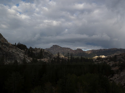
This picture above was as we hiked down a long canyon on our last day with the clouds but beautiful views of the country.
This is a typical section of the trail (but not always going up) and the clouds breaking with some sun.
We were decending from about 8,400` to 6,320` at the end. As we dropped down the trees changed from pines & junipers to this stand of Aspen trees.
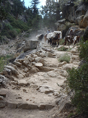
Again as we were stopped for lunch the packers passed us on their way to Kennedy Meadows pack station.
We had a great view of the stock from our lunch ledge as you see below.
L -R: Mary, Bill & Maryland. The next picture is of the mound of our gear (and the packer`s) that the mules carried for us, piled on the loading dock at the Kennedy Pack Station. Thank you to the mules!!!!!!!
This last shot is the loading of the stock on a transport truck. Too much fun until of next hike!!!!!!!
Looking back at Grizzly Meadow, you can see our trail (barely) at the center of this picture.
Near the top of Brown Bear Pass was interesting with different types of geology on both sides (yes that is my thumb on the left).
Most of the trail was in good shape but we found several sections that were very rocky and difficult to walk on - see below.
Most times we knew or could find where the packers had established camp (since they were usually several hours ahead of our arrival). But on this last night`s camp the place they had to use was off the trail. We found this note in the middle of the trail with a piece of colored tape. It was a good thing since it had been a long day (8:00 AM - 5:00 PM) on the trail.
And a close up of the note - it was a welcome sign!
Our camp fire was located on top of a large granite boulder and had a great view. For the first time on our trip the clouds started to form and we thought it meant RAIN!
This picture above was as we hiked down a long canyon on our last day with the clouds but beautiful views of the country.
This is a typical section of the trail (but not always going up) and the clouds breaking with some sun.
We were decending from about 8,400` to 6,320` at the end. As we dropped down the trees changed from pines & junipers to this stand of Aspen trees.
Again as we were stopped for lunch the packers passed us on their way to Kennedy Meadows pack station.
L -R: Mary, Bill & Maryland. The next picture is of the mound of our gear (and the packer`s) that the mules carried for us, piled on the loading dock at the Kennedy Pack Station. Thank you to the mules!!!!!!!
This last shot is the loading of the stock on a transport truck. Too much fun until of next hike!!!!!!!
Saturday, September 22, 2012
Sierra Hiking Trip - Part 2
We are headed toward Tilden Lake elev. 8,900` and slightly off the main trail. It is about 2-3 miles long and the site of our second layover day ( it is now day 8).
This next is a shot of Tilden Lake taken from the inlet end looking south down the lenght.
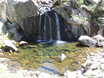
As usual I went for a hike up the lake and found this 12-15` high waterfall on the stream that feeds the lake.
There were still some flowers out but most had already finished.
A few high clouds to make a better picture, just the way we like them - NO RAIN!
Up close and personal with one of the mules - I think he thought I might have some FOOD. Below is part of the "herd" grazing.
Another morning shot of the Tilden Lake (with the moon still up) as we prepare to leave.
Sierra Hiking Trip 8-2012 Part 1
Our annual hiking trip in the Sierras occured between 8/26 & 9/5/12. The hike started in Yosemite National Park at Toulumne Meadows area which is in the northern part of the park. Our route took us north on the Pacific Crest Trail and ended at Kennedy Meadows on Hyw.108, west of Sonora Pass.
There were only four of us hiking this year plus or cook & wrangler. We covered about 80 miles of the trail and the weather was perfect.
I know, enough with the details, let`s see some pictures!!!
This is Smedberg Lake elevation 9,219` and our first layover day (a rest day where we camped for two nights). This was day 3 of our hike and a great place to enjoy. I took the day off to hike to Rodgers Lake which is off the main trail. See it below, complete with islands in the middle, elev.9,507`.
During the day (also most evenings) some of the stock would be turned out to graze, as in this shot. Here they had a marshy area and lots of grass.
Next is an evening shot across Smedberg Lake with the moon reflecting on the water and a rock in the foreground.
Above is our camp (in the trees to the left by that large rock), this shot was taken in the morning before the breeze came up. The reflection pictures came out better that looking into the bright sky with the light reflecting on the granite mountains.
This is our group: L-R - Our cook, Adell; Maryland; her husband Bill; Mary & our wrangler, Tyler. We even had sections of trees to use as tables.
The next pictures are of the kitchen area. First the cook`s tables and then the storage boxes (bear boxes).
To be continued.........
There were only four of us hiking this year plus or cook & wrangler. We covered about 80 miles of the trail and the weather was perfect.
I know, enough with the details, let`s see some pictures!!!
During the day (also most evenings) some of the stock would be turned out to graze, as in this shot. Here they had a marshy area and lots of grass.
Next is an evening shot across Smedberg Lake with the moon reflecting on the water and a rock in the foreground.
Above is our camp (in the trees to the left by that large rock), this shot was taken in the morning before the breeze came up. The reflection pictures came out better that looking into the bright sky with the light reflecting on the granite mountains.
This is our group: L-R - Our cook, Adell; Maryland; her husband Bill; Mary & our wrangler, Tyler. We even had sections of trees to use as tables.
The next pictures are of the kitchen area. First the cook`s tables and then the storage boxes (bear boxes).
To be continued.........
Subscribe to:
Comments (Atom)


