The peak on the left is Wheeler Peak and the one on the right is Bald Mountain (elevation 11,562`). The valley is about 5,300` elevation so that is a great difference in the climates. The road goes up to 10,000` elevation and from the view from up there you can see quite aways.
Looking east with pine trees and junipers up on the hill and desert down below. Those hills in the distance are in Utah and are about 50 miles away.
A little closer view of the peaks with a heavy blanket of snow on top. Wheeler Peak is the one on the right with a dark face.
A closer look at Wheeler Peak (center of shot) across a ice covered Teresa Lake (elevation 10,230`). This was on the start of my hike and a clue of the temperatures farther up the climb!!!!
Did I mention that it was COLD! Here is a small stream off to the side of the trail and it was all but frozen over. It is beautiful though.
This log had a sheet of ice hanging from it due to the water splashing up & freezing.
As my hike approched the tree line (usually about 10,000`, over which there is not enough oxygen for trees to grow) I found myself hiking through a grove of Aspen trees who had already lost their leaves.
The trail (marked mostly by other hikers foot prints) headed up and the angle of the hill was getting a little steep!
Looking to the right, the view back down to the valley was great & a little intimidating. You can see some foot prints at the bottom of this picture going straight up the hill.
I walked over to the edge of the ice field and got a nice picture of Wheeler Peak in the distance. This is when I decided to turn around since it was blowing and cold. This is about at the 12,000` elevation level and that was it for me!!!!!
Anyway my feet were getting COLD and that was not going to be a good thing. All in all I covered about 6 miles and gained about 2,000` elevation (most of it in the last couple of miles going up).
One last look back at the mountain, trying to see where my hike had taken me. I was on the right side of this shot, just below what looks like a level area (it was not) next to the edge of that snow face. Whatever.
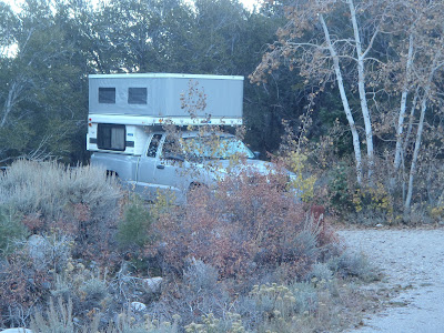
Home sweet home. This Baker campground (elevation 7,530`) it has 36 sites and I was the only one there. It was very quiet that evening and a little cold. But in the morning I was in for a supprise.
All is well - Good night.


No comments:
Post a Comment