Tuesday, October 25, 2011

Fall Trip North - Day 6

As you may notice I have am a few days behind in my blog.  Reception of a signal is to blame and not that I am having so much fun, which I am!

Day 6 (Sunday) was a drive into Yosemite National Park and then a visit to Hetch Hetchy Valley Reservoir.  Driving up Tioga Pass (the eastern entrance to the park) goes from about 6,500` to 9,945` in elevation in about 16 miles - can you say "steep".  Of course it is worth it as you will see (for those of you that have never been there).
This is Ellery Lake elevation 9,538` - looking west and still on the climb up Tioga Pass.

A view of Tenaya Lake.

As I was driving through the high country, I could not help getting a picture of Clouds Rest  from a side view.

Next was another (I`ve never been there trip) to Hetch Hetchy Reservoir which is a long and winding 17 mile road. 


On top is a view from about half way out the drive to the reservoir and the bottom is from the dam looking east.

There is a hiking trail around the side of the reservoir (you have to go through a long tunnel of solid rock) that gives you a different view of the dam (at the right center of the shot).
This taken from the end of my hike and shows Kolana Rock with a look back up the reservoir.
I found this sign at the point I turned around,  it shows some of the places we hope to hike next year.

I camped at Hodgdon Meadows, one of the only open campground inside the park.  It was fine except several of the groups (those young people) stayed up a little late.

A great day any more to come.  That`s all folks

Saturday, October 22, 2011

Fall Trip North - Day 5

It is now Saturday 10/22 and I spent most of the day catching up on emails and stuff.  I finally hit the road about 2:30 from Mammoth and drove to Lee Vining (just outside the east entrance to Yosemite National Park).  No major hiking or cycling but I did check out Mono Lake and the "tufas".  A "tufa" is calcium carbonate formation that have bubbled up through the very salty water of the lake.  Mono Lake is many times saltier than the ocean due to high rate of evaporation.  I know, "don`t make this a geology lesson & no, there will not be a test at the end".
But first a picture of my camper trying to hind behind a large pine tree.  Actually this is my camping spot a Twin Lakes - up the hill from Mammoth Lakes, Ca.   Ha, ha.
And now for some pictures of Mono Lake and the "tufa" mounds rising out of the water.
These are about 10` tall .
This one is about 20` tall & great reflections in the still water.
Lots of water birds dining on the brine shrimp in the water. 
Sunset over the lake with some of the tufa formations visible at the lower left.  This is looking northeast.

Just to end on a bright note, here is a bee doing what bees do best - when they are not stinging people.
I think that is enough for this blog, so until tomorrow, Adios

Fall Trip North - Day 4

A few last pictures from the morning at Convict Lake.  I just had to check out the lake early (8:30 - that`s early for me, after all I am retired), plus the mornings are quite cold - 39 degrees last night.  Now I am headed to Mammoth Lakes area.


I am now in the Mammoth area and was able to do a hike to Duck lake yesterday.  This hike was inspired my my neighbors who made part of the same hike recently.  Yes, Jim & Julie, this is for you.  I did not get a early start and it was a good thing since it was still cool on the first shaded part of the hike.  The lake are stunning with the new snow and clear water.
First lake you see is Arrowhead Lake which is small and right beside the trail.
Next is Barney Lake (actually several small lakes connected) at 2.5 miles up the trail.  Below is a panorama (l - r) with the reflections of the show in the water.
Next is a view for the lake from half way up the trail to Duck Pass.  This is a view that you`ll did not get to see.
The trail comes into this lake at the far end and you can see Heart & Arrowhead Lakes to the right in distance.  The next shots are of Duck Lake (elevation over 10,000` but I am not sure of the exact height). 
There are two pictures that are l -r.
This is the same shot but using the telephoto feature and with the lake surface effected by the sun & wind.  You are looking toward the outflow of the lake as it flows down to Purple Lake (which is on the John Muir Trail).
I found the perfect little Christmas tree and it a fresh blanket of snow at the base.  The only trouble is that by Christmas time it will be completely covered with a deep pack of snow. 
Today has turned out to be a rest day and it was necessary to catch up on things.  I may stay here another night and head for Yosemite tomarrow.  An open schedule (whatever that is) seem to be a good thing. 
Greetings from "Bicycle Bob".

Thursday, October 20, 2011

Fall Trip North - Day 3

I am camped at Convict Lake (south of Mammoth Lakes - on Hwy. 395).  Last night was cold (about 37 degrees) but I was very comfortable in my camper.  That is until I had to get out of bed and get dressed.  I set off on my hike around the lake and up toward Mildred & Dorothy Lakes.  I intended to get to Dorothy but that is a 12 mile (round trip) hike and about 3,000` of elevation.  My start at 9:30 and the shorter days made me turn around at Milderd Lake (10 mile round trip and about 2,200` of elevation).  Great hike and again the Aspen trees are in full color.
A look at the trail and the Aspen trees.  My destination is above where the two sides meet in the distance.
This is about the 9,000` elevation mark and as you can see the trail has some good patches of snow (which you have to cover since there is no way around).  They had a two foot snow several weeks ago and this is some of what is leftover.
First view of Mildred Lake (just part of it) and Red Slate Mountain in the distance (it is the one at center with the vertical snow line down it).  Actually it has that snow feature all year round.  Still a lot of snow up there.
the right half of Mildred Lake with the reflection of the mountains beyond, really clear water & cold.
Convict Lake on my return, My campground is in the distance to the right.  You can see the White Mountains in the very far distance & they still have a good bit of snow as well.
My hike was 3 1/2 hours up and 2 1/2 hours down, with great weather the whole day.
On my return to camp, I decided to get cleaned up and refreshed by taking a dip in the lake.  Yes, it is quite cold but felt good. 
Off to Mammoth high country and a hike to Lake Virginia (a lake we passed on the John Muir Trail several years ago).  It is a stunning lake and I think it within a days hike - we`ll see.

More stuff to come.  Good night

Wednesday, October 19, 2011

Fall Trip North -Day 2

I will start off saying that staying in an RV park is not ideal.  The reason is that so many people are jammed into a small space.  Most have the monstrous motor home and have a "dust mop" size dog that barks all night.  Of course they have taken their hearing aids out, so they don`t hear anything.  Ok, I got that out but the hookups are the reason to use a RV park most of the time.
Wednesday started out with a drive north on Hwy, 395 to Tom`s Place at the top of the Sherwin Grade out of Bishop.
I found a book about great bicycle rides up & down the Sierras.  One ride starts at the highway and goes up to the end of Rock Creek Road / Mosquito Flat.  The ride starts at 7,040` elevation and ends at 10,300` elevation over a distance of 10.5 miles with a total elevation gain (gains & loses) of 3,500`.
So I decided to ride it & got started about 11:00, due to the drive.  Beautiful fall colors in the Aspen trees and other plants.
It was a good road and very little traffic.
The Aspen trees are in their prime.

This is near the top of the road & a nice view of the mountains which had just had 2` of snow about a week ago.
Back at the truck with a cleanup and stow the bicycle.  Headed for Mammoth Lakes & a late lunch (Mexican food - my favorite).  Then headed south (a little) to Convict Lake where I will camp for the night - elevation7,850`.
Here are a few shots of Convict Lake where I plan to start my hike tomorrow.
These are for Mary - just few pictures of "stuff".


This is on the bridge at the out flow from Convict Lake - elevation 7,850`.

That is it for now.  Traveling Fool

Tuesday, October 18, 2011

More stuff about the pictures

I just found out that by clicking on any of the pictures and then rolling the "mouse" thing, you can see all of the shots a little bigger. Just click off the picture and it returns to the "dribble", I mean blog.  Whatever.

Fall Trip North -2011

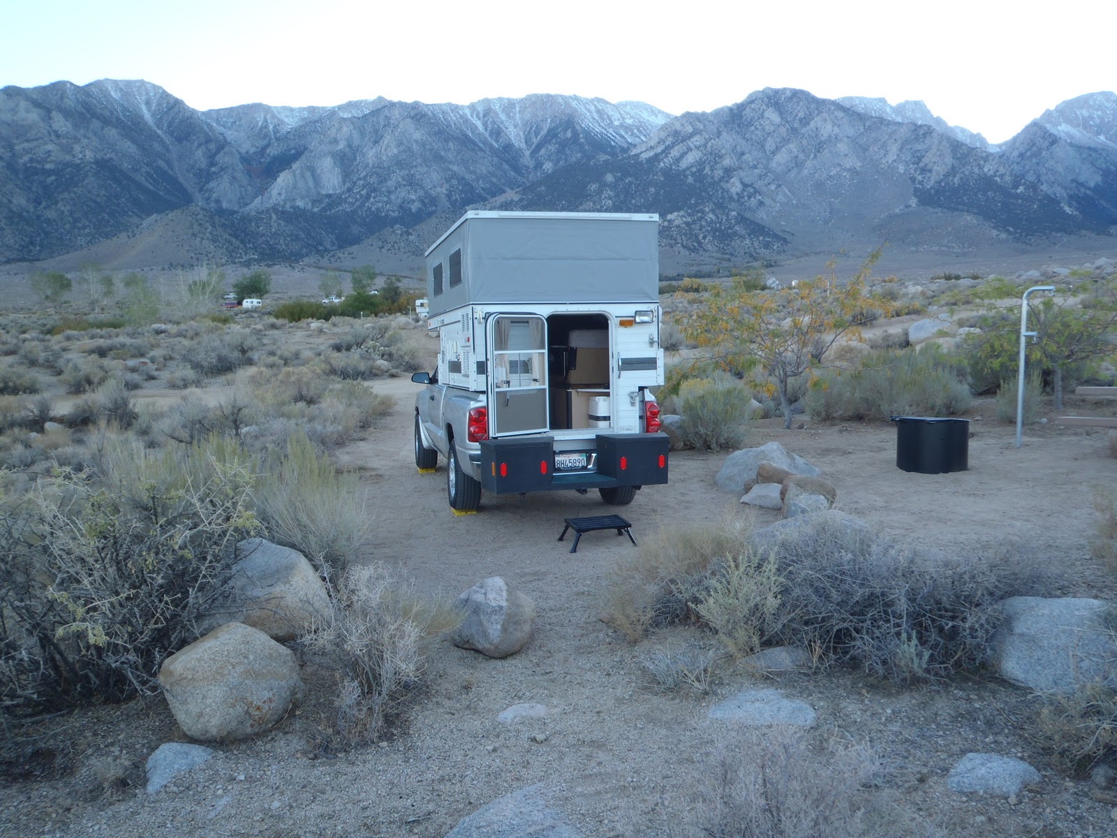
I started this trip on Monday 10/11 at about noon and made it to Lone Pine, Ca.   I found a great Forest Service camp up the hill to the west.  For those of my Sierra hiking group. it is off the road to Horseshoe Meadow - Tuttle Creek - on the level part before it starts to climb.  A great campground and with my "senior pass" it was only $2.50 a night.  No hookups but a wonderful view of the road to Onion Valley (the road leading to the trail head for Kearsarge Pass hike.  That night I did get the sensation that my camper was not as level as I had set it up to be.  In the morning I found out why - a flat tire on the (down hill side) left rear (of course the most difficult to change).  So after breakfast I got my morning exercise.  I headed to the tire shop, here in town, and found out that the tires I had on my truck were designed of a passenger car / light truck.  The road up to the campground was a dirt road but seemed OK - I guess having all of this weight and any sharp rock are not a good match.
So I decided to bit-the-bullet and get 4 new, heavy duty tires - not that I haven`t gotten really good at changing tires but............  I also found out that my old tires were at best nylon 3 ply and the new ones are steel 10 ply - take that you ROCKS.  I will now have more confidence if I need to drive on dirt roads in the future.
Being as how it was now about 10:30 and the shop would need my truck until sometime after lunch, I thought a bicycle ride was in order.  I have had on my "bucket list" for several years a ride from HWY. 395 up to Horseshoe Meadows (a roughly 6,000` climb).  It is a long switchbacking road up the side of the mountains just south of Mt. Whitney in the Sierra Nevada range.  We have started our hikes at the trail head and I have wanted to give it a try.
Being that I had to be back to pick up my truck by 5:00 and starting rather late, I made it about 2/3 of the way up in about 2 hours.  At that point needing more water and the effort needed to get the rest of the way up, caused my to head back down.   I got 15.1 miles/ 30.2 round trip and the trip back only took about 1 hour (going up - 5 mph & going down 25/30 mph). 
I opted for a full hookup RV park tonight so I could get cleaned up and BLOG.
Headed for a place just north of Bishop, Ca. - hiking at a trail head up Rock Creek Rd. tomorrow.
I know "how about some pictures" well check them out.
Not a bad back yard and it looks like a recent light dusting of snow on the tops of the mountains
I found out about a different way to get to the Horseshoe Meadow road.  Since I was south of Lone Pine, I headed  further south (3 miles) to a road up that connected a the base of the climb.  It saved me about 12 miles from having to go back to Lone Pine and then up to the turn off to the left from the Onion Valley road.
This one is for you Mary, I found it in the middle of the climb to Horseshoe Meadow - notice the yellow line which is the center marking for the road.  I did not have to worry about traffic since only two cars passed me the entire way up.  There is one at each of the switchbacks on the road - this was the best - I guess there is something under this cap but I could not budge it.......
This is a view of Lone Pine (the green patch in the distance) from part way up the mountain (looking northeast up the Hwy. 395 valley) & you can make out the road I took up at the left, beyond the trees. 
Part of the road up & going back down was fun but tiring on the hands - braking all the way.
A look up to where the road goes from the point where I turned around.  It was still a ways and (for an old guy) not a bad ride.  I figure about 4,200` climb ending at about 8,000` elevation.  That is off the list even though I did not make it to the top - close enough!
Back down and I thought a look at the climb might help (it is a little hard to see).  You can make out the switchbacks and the reflection from a car on the climb.  I think if you click or double click the picture, it makes it bigger. 
That is all for now, Cheers.