Saturday, June 30, 2012

Canada Trip - Wednesday 6-27

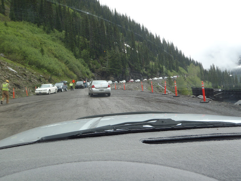
After spending a day in my camper catching up on my blog, it was a nice day and time to check out Glacier Nat. Park. Clearing skies (first I have seen in a week), I headed to drive the "going to the sun" road.  This is the one road that cuts across the park (west to east) and goes over Logan Pass (elevation 6,646`).  It is a narrow road and they are doing a lot of road work, which means delays.  One was a half an hour!  I know, show me something!!!!
I am sure that is not what you wanted to see, so.....how about these from the first part of the drive?
Above is a huge water that is cutting across (under) the road where I was headed.  If you look carefully the tunnel under the roadway where the water goes, can be seen.  Note the clouds above, I get into them later.
Did I tell you about the construction on this road which at places is only wide enough for two regular cars to pass each other? 

This is the long line of cars waiting to come down - one way traffic make it slow going, but what is the alternative?
Due to the heavy traffic (after the one way wait) I could not stop (actually there was not any place) so I just took pictures while driving.  The point above this stream is very near the top of the climb (note the road & line of cars at the left).

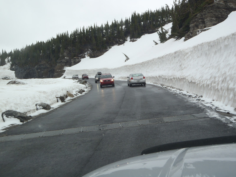
From all the rain and snow melt the water was just pouring off the side of the hills.  You can see all the water on the road.
Did I mention there were a lot of waterfalls?

Oh, did I tell you there was a lot of snow at the top - those drains across the roadway helped to channel the water off the road.  In the morning this section was closed due to "black ice" (frozen water on the road that you can not see).
This is the visitor`s center at Logan Pass (the highest point on the road).  Note the US & Canadian flags since we are very close to Canada.  And yes it was cold up here, just above freezing. 

I "quickly" walked up on the snow pack behind the visitor`s center and felt like I was in the artic, taking this picture!


This looking east with the road going down at the far left.  You can see the cloud layer was still high but it looks clearer toward the east.  But it is still cold here!
More snow and big waterfalls, I could not resist.

Great tunnels through the solid rock and of course this was a driving shot.

They have these vehicles to carry tourists around all though the park area.

One last picture looking back at the park from the east side.  A great park and I have to go back "after school is back in" to cut down on the traffic. 
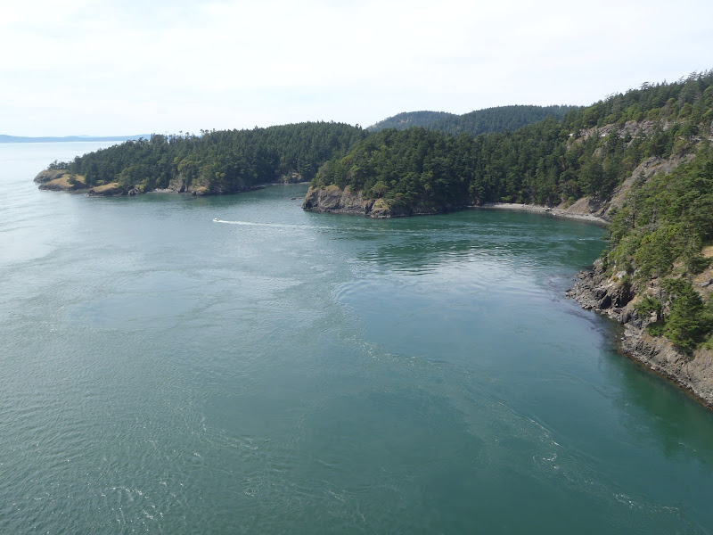
I am hanging out in Seattle ( actually Vashon Island) for a few day.  More about that later. 
I am all do for now.

Wednesday, June 27, 2012

Canada Trip - Sunday - Tuesday 6-24 to 6-26

As soon as I landed in Vancouver it was pouring rain, so I drove.  I was heading northeast toward Jasper in the Canadian Rockies but.....  I  found out that with all the rain and snow melting the rivers were overflowing.  Along with that there were a lot of road flooded or rockslides blocking them.  This changed my route, as you can imagine. 
It was recomended that I go down close to the US border (but still in Canada) and go east.  The hope is that the roads from above Montana (in Canada) would be open when I got there......
On Tuesday I finally was headed north to Baniff, British Columbia and ran into a torrential rain / hail & wind storm.  It was so bad I could not see to drive or hear myself think.  I was afraid that if I did get up to the parks, I might get stuck.  There was much more rain forcasted and that sealed the deal for me.  I turned around and headed south and back into the US. 
During the time I was in Canada I could not get my internet connection so I "went dark" as far as the blog.
No pictures, sorry but the driving was to intense with the rain and all!
I will make admends with the pictures I took while driving through Glacier Nat. Park - in Montana.  But that is tomorrow`s blog.  TTFM 

Canada Trip - Saturday 6-23

I forgot to include a picture of the entrance to Sproat Lake campground, yesterday.
I did a little touristing in several small cities before heading for the ferry over to the mainland and Vancouver.  The weather was raining and overcast which prompted me to book the ferry.  The small city of Qualicum Beach is the next series of pictures.  I stopped in for breakfast and checked out their farmer`s market, as well as the rest of the community.
As you can see it is a very beautifully kept city.  Below is the town clock and behind it a great blooming "Dogwood" tree.
I will wrap up with a picture from the ferry on the way over to Vancouver.  It shows another ferry and the hills beyond.   
Another short picture taking day.  I just did not see anything worth stopping for.  The End

Canada Trip - Friday 6-22

A quiet & restfull night at Sproat Lake Provincial Park.  I had been told about a base for one of the worlds largest fire fighting planes also at Sproat Lake.  So I had to go check it out, since I was right there.  As It turned out the base was right around the corner from the park.  The next morning I drove there but it was closed.  Still I got some pictures.
As you can see the size compaired to the fuel tanker truck to the left.  This picture was taken through the fence.

The other plane anchored out in the water.  They are able to scoop water while crusing across a lake.

Something I had to get use to was thinking in Km/h instead of MPH.  Luckly I noticed the speedometer on my truck also had the metric indications for kilometers/hour.  This one was in the campground. 
More driving than picture taking, so that it for today.

Tuesday, June 26, 2012

Canada Trip - Thursday 6-21

Landing in Canada I drove to Sidney, B.C. which is the government seat for British Columbia.  This is the main government building which is like our state capitol building.

This shows the banners that are celebrating Queen Elizabeth`s 60 years reign. 
Above is the Mile "0" marker for the trans-Canadian highway.  I last was here 42 years ago while driving around Canada & the US with a highschool friend in my brand new 1970 Karmann-Ghia VW.  This was big objective on this trip.
While walking around in downtown Sidney, I could not resist a picture of this bicycle rack.  It is shaped to symbolize the name of the isalnd - Vancouver Island.  I thought it was very creative.
Another destination was Butchart Gardens which is over a 100 years old.  I will only include a few pictures of the roughly 60 shots I took during my 3.5 hour walk though.

You will have to try and picture these two shots above as one large area.  This is only one of 5-6 different parts of the garden.  It is more than 55 acres and most of that is perfectly landscaped.  The one I liked the best is the Japanese Garden. 

Above even the trash recepticles are decked out with flowers.
There are litterally 40-50 different types of Colombines and all in peak bloom.  I could be here all night showing you pictures of this amazing garden.  They also had several acres of Tuberous begonias, of all colors & in full bloom.  A must if you are ever in the area.
I headed north (or as they say "up island") to find a camping spot, ending up at Sproat Lake Provincial Park.  It is almost in the dead center of the island a near the top of a ridge running up the center of the island.  It rained almost the whole time I was in Canada but "it is green".
More stuff when I get back to this blog.  For now "I`ve got blisters on my fingers".  Goodnight

Canada Trip - Wednesday 6-20

Two ferry rides and half a day latter, I ended up at Anacortes, Wa. (which is just east of the San Juan Islands).  This is my jumping off place to take a ferry to Vancouver Island, Canada.  I spent the night in Anacortes at Washington Park which is a city park with lots of great RV camping spots.  It is right near the ferry terminal, which is good since my ship was leaving at 8:15 A.M. sharp (I had to be there one hour early)!  A required picture of my truck/camper on the ferry comming over to Anacortes along with a tractor.  Sorry Phil but I do not know what type of tractor this is.


One the drive to Anacortes I stopped at Deception Pass, which is a high bridge between two parts of the islands.  First a view from the middle of the bridge and then a shot from down at the beach barely visible through the trees(in this first shot) at the lower left.
Ok, one more picture from the bridge looking just to the right showing the beautiful coastline.
Last but not least is my camp that night in Washington Park.  You may notice the I postioned my laptop with my screen saver (Mocca the cat) on the back so I could say she was traveling with me.  The woods of this "park" made me think I was in the wilds somewhere.  Notice the moss on the north side of the trees.
A quiet night since there was only one other camper nearby.  Amazingly it was the same type of camper as mine (Four Wheel Camper) and they were from Calif. - what the chances.  Of course we had to compare "rigs".
Tomorrow Canada, if they let me in!  That`s enough for now.

Canada Trip - Tuesday 6-19

Today was over to Seattle again.  A nice resturant and a stop at REI (Recreational Equipment Store).  For those of you that know this chain of stores (outdoor equipment), this is the "mother ship" or as they refer to it as the "Flagship Store" (the original store).  They have a cool (man made) waterfall just outside that makes you think you are out in the wild.


 I want one like this but I would need a much bigger yard and lots of water.  Oh well, maby not! 

On the ferry headed back to Vashon the clouds over the city were nice but not typical for this area.  The view off the back I thought called for a picture.  This was a rare "blue sky" day with puffy clouds.

In the yard there was one bloom that had opened, I think just for me since I was leaving the next day.
The name is "hypericum" or St. John`s Wort.  It is about 2.5 inches across and bright yellow.  On to the north and new places to see.  Catch you on the flip flop.

Canada Trip - Monday 6-18

The plan today was to drive west as far as we could, which meant to the ocean, west of the Olympic Nat. Park.  The road goes through some dense forests and we ended on a rocky beach.  A stop was made at Quinalt Lake and a nice old lodge on the shore.  A very tranquill place.

The Quinalt Lodge would be a great place to stay.  Built in 1894 but rebuilt in 1924 after a fire, it has that old world charm.  The lake is large and they provide canoes and have a small beach to relax.
Of course there is wild life and porbably more than we saw (which in the case of bears, that`s a good thing)
Above a "crested blue jay" and a "red" squirel work the bird feeder over.   Below is one of the many plants and flowers that grow wild in the area.  This one is called (I think) Turkish Hat and looks like the name.
Finally we found a beach which had nothing but smothed granite rocks as far as you could see plus lots of drift wood.
  Above looking north - below looking south.  My truck is just above in the center.  I have to get it in.
A long drive but we got to see some beautiful country.  That all she wrote......